
By John Dobberstein, Editor
The National Weather Service released an updated assessment of last Friday’s severe storms as they hit Broken Arrow and Oneta in Wagoner County, identifying 2 brief tornadoes that caused minor damage.
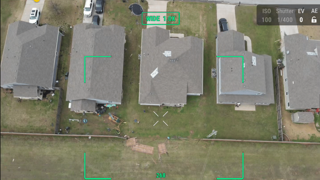
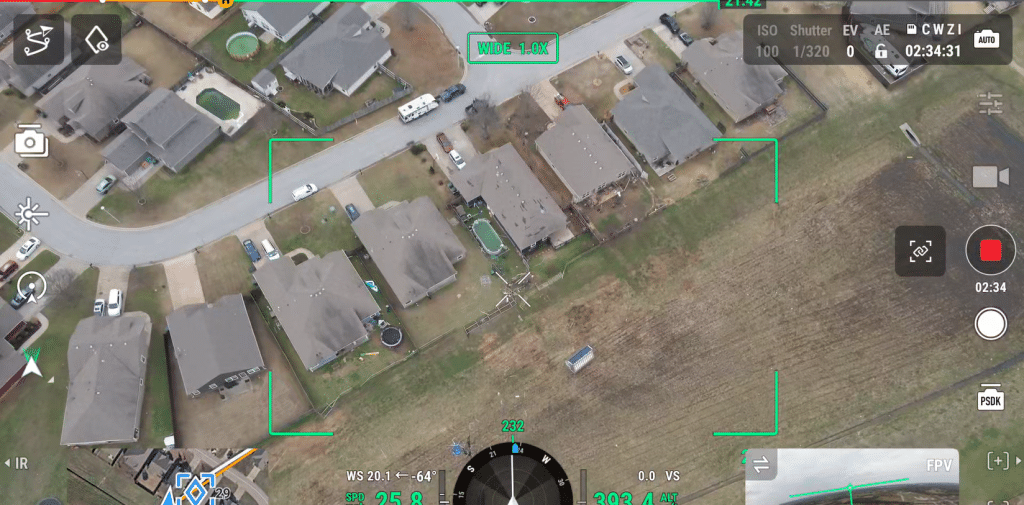
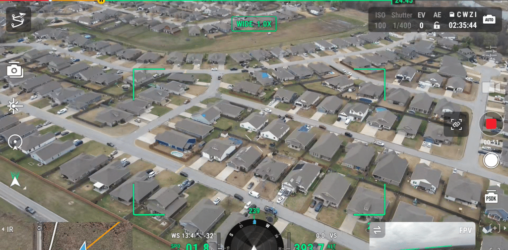
The first tornado, rated an EF0, developed shortly after 8 p.m. just south of the Muskogee Turnpike and east of S. 225th East Avenue. It moved northeast across a neighborhood west of S. 241st East Avenue and into the southern portion of Forest Ridge.
This tornado, packing winds of 80-85 mph with a path width of 130 yards, uprooted a few trees, damaged the roofs of several homes, snapped large tree limbs and blew down large sections of privacy fences. The path lasted about 1.5 miles, and there were no reported injuries or deaths. It dissipated 3 minutes after starting.
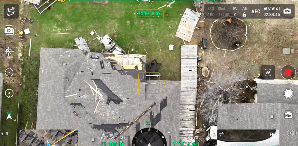
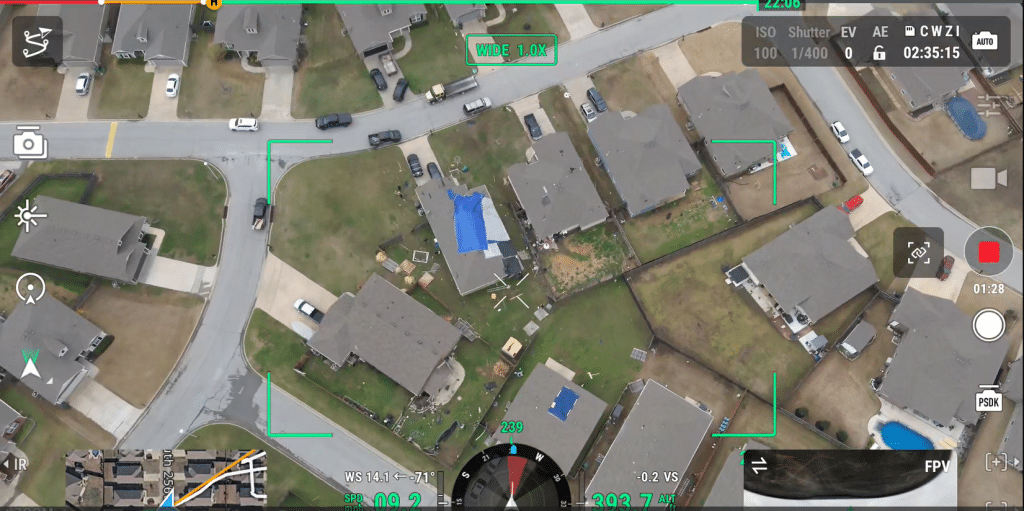
SLIDESHOW OF DAMAGE
(NWS photos)


Going ‘anticyclonic’
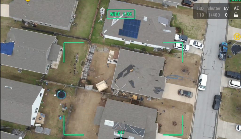
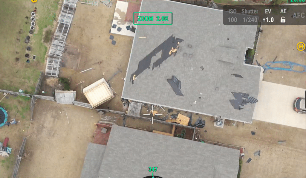
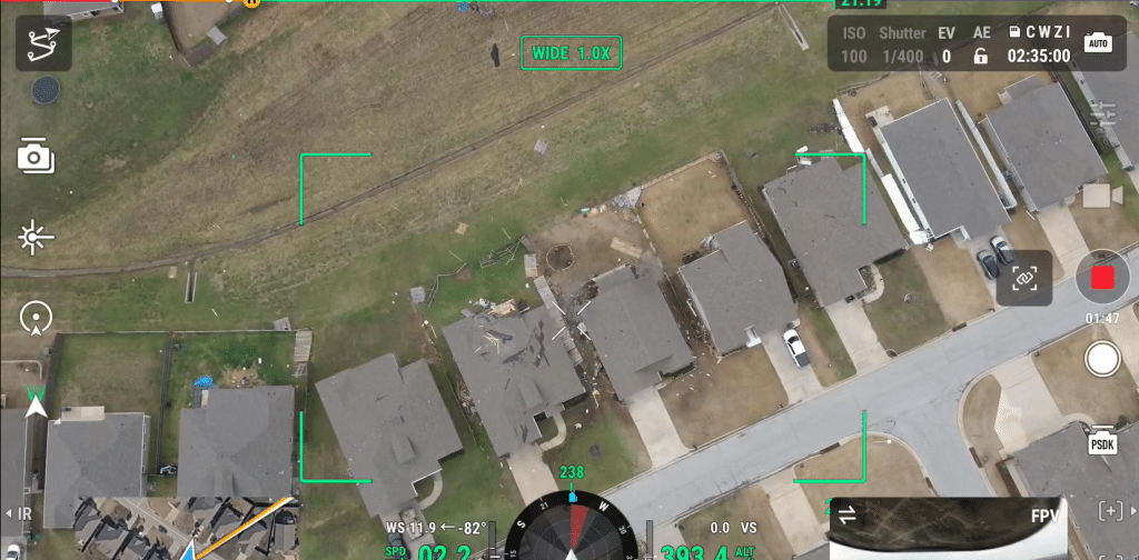
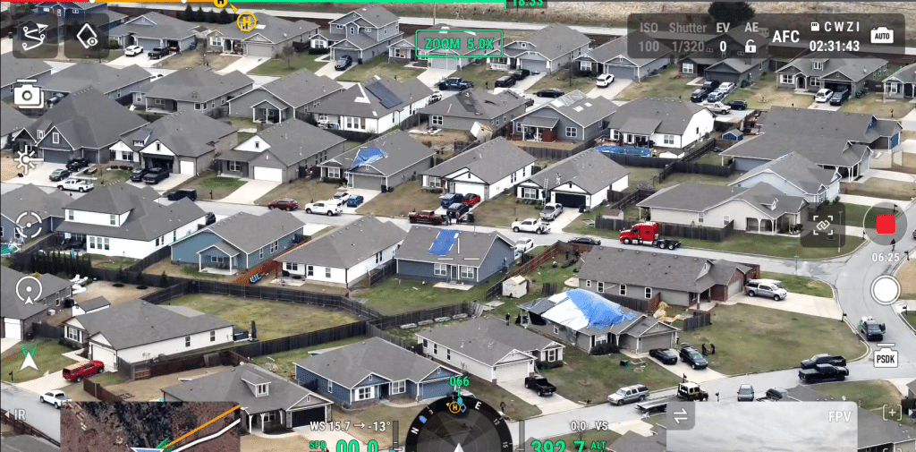
Around the same time, an EF1 tornado dropped in Oneta over open country north of E. 91st Street South and west of S. 257th East Avenue. It moved northeast across a neighborhood west of S. 257th, where the roofs of numerous homes were damaged and windows were broken.
The tornado damaged the roofs of more homes east of S. 257th, along E. 85th Street South, E. 86th Street South and Joy Avenue.
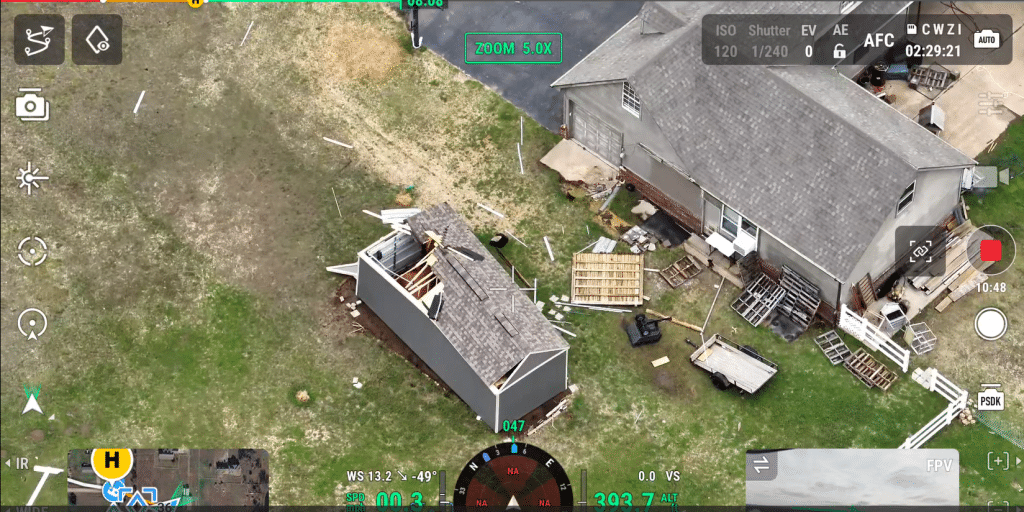
Several outbuildings were also damaged in this area, trees were snapped or uprooted, and numerous large tree limbs were snapped. Surveyors said the tornado’s peak winds were 90 to 100 mph, with a maximum path width of 300 yards and a 1.6-mile path.
The tornado dissipated 3 minutes later just west of S. 273rd East Avenue. Radar data indicated this twister rotated anticyclonically — or in clockwise direction. Ninety-eight percent of tornados travel in a counter-clockwise direction.


Leave a Reply